
Faça uma doação
Mapa topográfico Hamshire
Clique no mapa para exibir a altitude.
Faça uma doação
Sobre este mapa
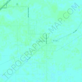
Nome: Mapa topográfico Hamshire, altitude, relevo.
Local: Hamshire, Jefferson County, Texas, 77622, United States (29.84161 -94.33241 29.88161 -94.29241)
Altitude média: 6 m
Altitude mínima: 3 m
Altitude máxima: 10 m
Faça uma doação
Outros mapas topográficos
Clique em um mapa para visualizar sua topografia, sua altitude e seu relevo.
Port Arthur
United States > Texas > Jefferson County
Port Arthur sits in a low-lying coastal area of the Gulf Coast, characterized by its flat, marshy terrain. The city is located at an average elevation of just 8 feet (2 meters) above sea level, with parts of the surrounding region even closer to sea level. Its topography is dominated by wetlands, tidal…
Altitude média: 2 m
Faça uma doação
Groves
United States > Texas > Jefferson County
According to the United States Census Bureau, Groves has an area of 5.2 square miles (13.4 km2), of which 0.015 square miles (0.04 km2), or 0.28%, is water. Most of the city sits at an elevation of 5 to 15 feet (1.5 to 4.6 m) above sea level.
Altitude média: 4 m
Faça uma doação