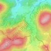
Mapa topográfico Upper Lusatia
Clique no mapa para exibir a altitude.
Upper Lusatia
The highest elevations of the German part of Upper Lusatia are in the Zittau Mountains (Lusatian Ridge), part of the Lusatian Mountains forming the border with the adjacent Bohemian region in the south, which today belong to the Czech Republic. The highest peaks of the Zittau Mountains are the Lausche at 792.6 m (2,600 ft)and Hochwald at 749 m (2,457 ft). The adjacent Lusatian Highlands comprise the Landeskrone (420 m), Löbauer Berg (448 m), Kottmar (583 m), Czorneboh (561 m), Bieleboh (499 m), and Valtenberg (587 m). However, the highest point of historic Upper Lusatia is the Tafelstein (Tabulový Kámen) in the Polish part, located at 1,123 m (3,684 ft) on the eastern slopes of the Smrk (Smrek) in the Jizera Mountains, the border tripoint of Upper Lusatia with the historical region of Lower Silesia to the east and Bohemia to the south.
Sobre este mapa
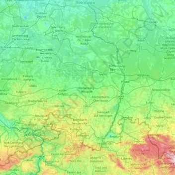
Nome: Mapa topográfico Upper Lusatia, altitude, relevo.
Local: Upper Lusatia, Saxony, Germany (50.81924 13.70940 51.59728 15.43337)
Altitude média: 260 m
Altitude mínima: 40 m
Altitude máxima: 1.419 m
Outros mapas topográficos
Clique em um mapa para visualizar sua topografia, sua altitude e seu relevo.


Ore Mountains
The higher altitudes from around 500 m above sea level on the German side belong to the Ore Mountains/Vogtland Nature Park – the largest of its kind in Germany with a length of 120 km. The eastern Ore Mountains are protected landscape. Other smaller areas on the German and Czech sides are protected as nature…
Altitude média: 443 m


Saxon Switzerland
Germany > Saxony > Sächsische Schweiz-Osterzgebirge
Saxon Switzerland forms the northern part of the Elbe Sandstone Mountains range, located on the German-Czech border. To the east, it transitions into the Lusatian Highlands and, to the west, into the Ore Mountains. The Czech part of the Elbe Sandstone Mountains is partly formed by the Bohemian Switzerland…
Altitude média: 341 m





Markersbach
Germany > Saxony > Erzgebirgskreis
In 1889, Markersbach was connected to the railway line from Schwarzenberg to Annaberg, which was closed to passenger transport on 27 September 1997. The station lay in Mittweida’s municipal area and the platform signs read Mittweida-Markersbach. To overcome the great elevation differential, the railway's…
Altitude média: 600 m







Reinhardtsgrimma
Germany > Saxony > Sächsische Schweiz-Osterzgebirge > Glashütte
Altitude média: 372 m




Topograph
Germany > Saxony > Sächsische Schweiz-Osterzgebirge > Rosenthal-Bielatal
Altitude média: 385 m