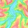
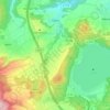
Mapa topográfico Vulkaneifel
Clique no mapa para exibir a altitude.
Sobre este mapa
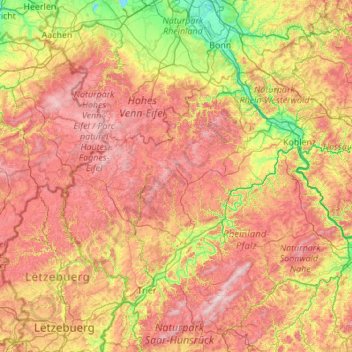
Nome: Mapa topográfico Vulkaneifel, altitude, relevo.
Local: Vulkaneifel, Rhineland-Palatinate, 54550, Germany (49.51276 6.12790 50.91276 7.52790)
Altitude média: 339 m
Altitude mínima: 41 m
Altitude máxima: 809 m
Outros mapas topográficos
Clique em um mapa para visualizar sua topografia, sua altitude e seu relevo.
Nürburg
Germany > Rhineland-Palatinate > Landkreis Ahrweiler
Nürburg has a semi-continental climate with both oceanic and continental tendencies. It does however land in the former category (Köppen Cfb). With regards to the racetrack, due to the Nordschleife's varied terrain and elevation, weather may be completely different on either end of the track. The elevation…
Altitude média: 560 m


Wörrstadt
Germany > Rhineland-Palatinate > Landkreis Alzey-Worms
Wörrstadt lies at an elevation that affords charming and, for Rhenish Hesse, remarkable views into the distance. From Wörrstadt, one can see the Donnersberg, the Wißberg and the Großer Feldberg in the Taunus. In good weather, Frankfurt am Main’s skyline can even be seen from a few spots within town limits.
Altitude média: 205 m
Mainz
Germany > Rhineland-Palatinate
Nevertheless, the post-war reconstruction took place very slowly. While cities such as Frankfurt had been rebuilt fast by a central authority, only individual efforts were initially successful in rebuilding Mainz. The reason for this was that the French wanted Mainz to expand and become a model city. Mainz lay…
Altitude média: 132 m

Eßweiler
Germany > Rhineland-Palatinate > Landkreis Kusel
The municipality lies roughly 25 km north of Kaiserslautern, 15 km east of Kusel and 4 km west of Wolfstein at the foot of the Königsberg, a mountain in the North Palatine Uplands. Eßweiler sits at an elevation of 260 to 280 m above sea level, and has also given the dale in which it lies its name, the…
Altitude média: 384 m


Bremm
Germany > Rhineland-Palatinate > Landkreis Cochem-Zell
The municipality lies at a bow in the river Moselle between Trier and Koblenz, among the sloped vineyards of the Calmont, which with an elevation of 380 m above sea level and a slope of roughly 65° is Europe’s steepest vineyard location. This stretches along the Moselle from Ediger-Eller to Bremm, and is…
Altitude média: 258 m





Nürburg
Germany > Rhineland-Palatinate > Landkreis Ahrweiler
Nürburg has a semi-continental climate with both oceanic and continental tendencies. It does however land in the former category (Köppen Cfb). With regards to the racetrack, due to the Nordschleife's varied terrain and elevation, weather may be completely different on either end of the track. The elevation…
Altitude média: 560 m
Wiebelsheim
Germany > Rhineland-Palatinate > Rhein-Hunsrück-Kreis
The municipality lies on the eastern edge of the Hunsrück, roughly 7 km from the Rhine at Oberwesel and 8 km north-northwest of Rheinböllen, at an elevation of some 440 m above sea level. It is bordered in the east by the Rhine Gorge, a UNESCO World Heritage Site and the part of the Rhine valley that…
Altitude média: 460 m
Heidenburg
Germany > Rhineland-Palatinate > Landkreis Bernkastel-Wittlich
The municipality lies in the Hunsrück south of the bow in the Moselle between Leiwen and Trittenheim. Between Heidenburg and the Moselle is the valley of the Kleine Dhron, a deep cut in the landscape. Not far downstream, the Kleine Dhron feeds the Dhron reservoir. An outstanding scenic view is to be had from…
Altitude média: 349 m
Neuenahr
Germany > Rhineland-Palatinate > Landkreis Ahrweiler > Bad Neuenahr-Ahrweiler
Altitude média: 242 m
Zell (Mosel)
Germany > Rhineland-Palatinate > Landkreis Cochem-Zell
Zell is an hour's drive from both Koblenz and Trier, more or less halfway between these two cities. The nearest town going towards Koblenz is Cochem, and the nearest two going towards Trier are Traben-Trarbach and Bernkastel-Kues. To both Frankfurt-Hahn Airport on the Hunsrück and the spa town of Bad Bertrich…
Altitude média: 287 m

Cochem
Germany > Rhineland-Palatinate > Landkreis Cochem-Zell
Cochem lies at an elevation of some 83 m above sea level and the municipal area measures 21.2 km2. The town centre with the outlying centre of Sehl upstream lies on the Moselle's left bank, while the constituent centre of Cond lies on its right. A further constituent centre, Brauheck, with its commercial area,…
Altitude média: 286 m
Deidesheim
Germany > Rhineland-Palatinate > Landkreis Bad Dürkheim
From a local climatic point of view, Deidesheim is part of the climatically favoured foothill zone of the Weinstraße region. With a mean elevation of 235 m above sea level at the forest's edge, the lands of the Deidesheim area reach down to some 130 m above sea level at the lower mid-slope area in the…
Altitude média: 194 m

Westerwald
Germany > Rhineland-Palatinate
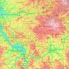
The Westerwald (German pronunciation: ; literally 'Western forest') is a low mountain range on the right bank of the river Rhine in the German federal states of Rhineland-Palatinate, Hesse and North Rhine-Westphalia. It is a part of the Rhenish Massif (Rheinisches Schiefergebirge or Rhenish Slate Mountains).…
Altitude média: 290 m
Eltz Castle
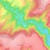
Germany > Rhineland-Palatinate > Landkreis Mayen-Koblenz > Wierschem
Altitude média: 219 m


Nürburg
Germany > Rhineland-Palatinate > Landkreis Ahrweiler
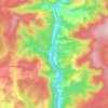
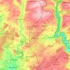
Nürburg has a semi-continental climate with both oceanic and continental tendencies. It does however land in the former category (Köppen Cfb). With regards to the racetrack, due to the Nordschleife's varied terrain and elevation, weather may be completely different on either end of the track. The elevation…
Altitude média: 560 m

Ahr
Germany > Rhineland-Palatinate
Ahr (German pronunciation: [ˈaːɐ̯]) is a river in Germany, a left tributary of the Rhine. Its source is at an elevation of approximately 470 metres (1,540 ft) above sea level in Blankenheim in the Eifel, in the cellar of a timber-frame house near the castle of Blankenheim. After 18 kilometres (11 mi) it…
Altitude média: 367 m