

Mapa topográfico Bremm
Clique no mapa para exibir a altitude.
Bremm
The municipality lies at a bow in the river Moselle between Trier and Koblenz, among the sloped vineyards of the Calmont, which with an elevation of 380 m above sea level and a slope of roughly 65° is Europe’s steepest vineyard location. This stretches along the Moselle from Ediger-Eller to Bremm, and is part of the Mosel wine region.
Sobre este mapa
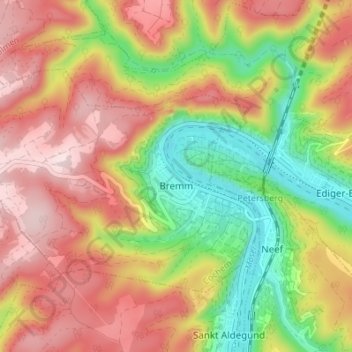
Nome: Mapa topográfico Bremm, altitude, relevo.
Altitude média: 258 m
Altitude mínima: 77 m
Altitude máxima: 422 m
Outros mapas topográficos
Clique em um mapa para visualizar sua topografia, sua altitude e seu relevo.
Moselhöhe Ediger-Eller
Germany > Rhineland-Palatinate > Landkreis Cochem-Zell > Ediger-Eller
Altitude média: 285 m