
Obrigado por apoiar este site ❤️
Faça uma doação
Faça uma doação
Mapa topográfico Providence
Clique no mapa para exibir a altitude.
Obrigado por apoiar este site ❤️
Faça uma doação
Faça uma doação
Sobre este mapa
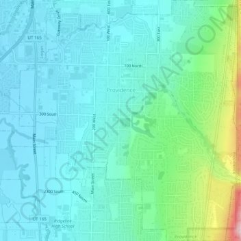
Nome: Mapa topográfico Providence, altitude, relevo.
Local: Providence, Cache County, Utah, 84332, United States (41.68375 -111.83798 41.71962 -111.79411)
Altitude média: 1.434 m
Altitude mínima: 1.364 m
Altitude máxima: 1.728 m
Obrigado por apoiar este site ❤️
Faça uma doação
Faça uma doação
Outros mapas topográficos
Clique em um mapa para visualizar sua topografia, sua altitude e seu relevo.
Logan Canyon
United States > Utah > Cache County
Logan Canyon is a canyon in the western United States in northeastern Utah, which cuts its way through the Bear River Mountains, a branch of the Wasatch Range. It is popular for both summer and winter activities, especially rock-climbing, hiking, camping, fishing, snowmobiling, and skiing, at the Beaver…
Altitude média: 1.780 m
Obrigado por apoiar este site ❤️
Faça uma doação
Faça uma doação