
Mapa topográfico Stanwell
Mapa interativo
Clique no mapa para exibir a altitude.
Sobre este mapa
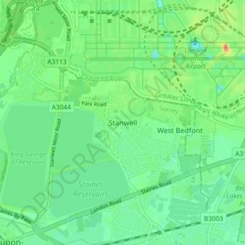
Nome: Mapa topográfico Stanwell, altitude, relevo.
Altitude média: 20 m
Altitude mínima: -1 m
Altitude máxima: 64 m
Outros mapas topográficos
Clique em um mapa para visualizar sua topografia, sua altitude e seu relevo.
Charlton
United Kingdom > England > Surrey > Borough of Spelthorne
Charlton, Borough of Spelthorne, Surrey, England, TW17 0ST, United Kingdom
Altitude média: 13 m
Laleham
United Kingdom > England > Surrey > Borough of Spelthorne
Laleham, Borough of Spelthorne, Surrey, England, TW18 1SD, United Kingdom
Altitude média: 14 m
Upper Halliford
United Kingdom > England > Surrey > Borough of Spelthorne
Upper Halliford, Borough of Spelthorne, Surrey, England, TW17 8SQ, United Kingdom
Altitude média: 13 m
Pharaoh's Island
United Kingdom > England > Surrey > Borough of Spelthorne
Pharaoh's Island, Borough of Spelthorne, Surrey, England, TW17 9LN, United Kingdom
Altitude média: 14 m
Shepperton
United Kingdom > England > Surrey > Borough of Spelthorne
Shepperton, Borough of Spelthorne, Surrey, England, United Kingdom
Altitude média: 12 m
Ashford
United Kingdom > England > Surrey > Borough of Spelthorne
Ashford, Borough of Spelthorne, Surrey, England, United Kingdom
Altitude média: 16 m