
Mapa topográfico Eastman
Mapa interativo
Clique no mapa para exibir a altitude.
Sobre este mapa
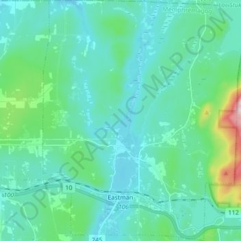
Nome: Mapa topográfico Eastman, altitude, relevo.
Local: Eastman, Memphrémagog, Estrie, Quebec, J0E 1P0, Canada (45.28441 -72.35806 45.37712 -72.24738)
Altitude média: 314 m
Altitude mínima: 241 m
Altitude máxima: 725 m
Outros mapas topográficos
Clique em um mapa para visualizar sua topografia, sua altitude e seu relevo.
Ayers Cliff Exposition Grounds
Canada > Quebec > Memphrémagog > Ayer's Cliff
Ayers Cliff Exposition Grounds, Ayer's Cliff, Memphrémagog, Estrie, Quebec, Canada
Altitude média: 174 m
Mont Éléphant
Canada > Quebec > Memphrémagog > Potton
Mont Éléphant, Potton, Memphrémagog, Estrie, Quebec, Canada
Altitude média: 389 m
Mont Hawk
Canada > Quebec > Memphrémagog > Potton
Mont Hawk, Potton, Memphrémagog, Estrie, Quebec, Canada
Altitude média: 345 m
Mont Singer
Canada > Quebec > Memphrémagog > Potton
Mont Singer, Potton, Memphrémagog, Estrie, Quebec, Canada
Altitude média: 603 m
Lake Memphremagog
Canada > Quebec > Memphrémagog > Stanstead (Canton)
Lake Memphremagog, Stanstead (Canton), Memphrémagog, Estrie, Quebec, Canada
Altitude média: 311 m