
Obrigado por apoiar este site ❤️
Faça uma doação
Faça uma doação
Mapa topográfico Magog
Clique no mapa para exibir a altitude.
Obrigado por apoiar este site ❤️
Faça uma doação
Faça uma doação
Sobre este mapa
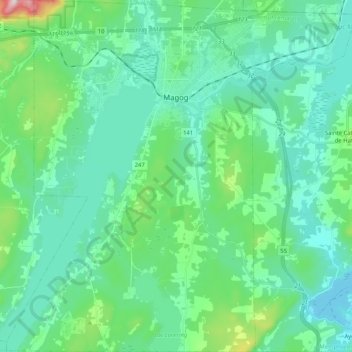
Nome: Mapa topográfico Magog, altitude, relevo.
Local: Magog, Memphrémagog, Quebec, Canada (45.16080 -72.24729 45.30571 -72.04219)
Altitude média: 250 m
Altitude mínima: 159 m
Altitude máxima: 674 m
Obrigado por apoiar este site ❤️
Faça uma doação
Faça uma doação
Outros mapas topográficos
Clique em um mapa para visualizar sua topografia, sua altitude e seu relevo.
Scouts Canada - Lake Lovering Scouts Reserve
Canada > Quebec > Memphrémagog > Magog
Altitude média: 260 m
Obrigado por apoiar este site ❤️
Faça uma doação
Faça uma doação
Obrigado por apoiar este site ❤️
Faça uma doação
Faça uma doação