

Mapa topográfico Kerala
Clique no mapa para exibir a altitude.
Kerala
The state is wedged between the Laccadive Sea and the Western Ghats. Lying between northern latitudes 8°18' and 12°48' and eastern longitudes 74°52' and 77°22', Kerala experiences humid tropical rainforest climate with some cyclones. The state has a coast of 590 km (370 mi) and the width of the state varies between 11 and 121 kilometres (7 and 75 mi). Geographically, Kerala can be divided into three climatically distinct regions: the eastern highlands; rugged and cool mountainous terrain, the central mid-lands; rolling hills, and the western lowlands; coastal plains. Pre-Cambrian and Pleistocene geological formations compose the bulk of Kerala's terrain. A catastrophic flood in Kerala in 1341 CE drastically modified its terrain and consequently affected its history; it also created a natural harbour for spice transport. The eastern region of Kerala consists of high mountains, gorges and deep-cut valleys immediately west of the Western Ghats' rain shadow. 41 of Kerala's west-flowing rivers, and 3 of its east-flowing ones originate in this region. The Western Ghats form a wall of mountains interrupted only near Palakkad; hence also known Palghat, where the Palakkad Gap breaks. The Western Ghats rise on average to 1,500 metres (4,900 feet) above sea level, while the highest peaks reach around 2,500 metres (8,200 feet). Anamudi in the Idukki district is the highest peak in south India, is at an elevation of 2,695 m (8,842 ft). The Western Ghats mountain chain is recognised as one of the world's eight "hottest hotspots" of biological diversity and is listed among UNESCO World Heritage Sites. The chain's forests are considered to be older than the Himalaya mountains. The Athirappilly Falls, which is situated on the background of Western Ghat mountain ranges, is also known as The Niagara of India. It is located in the Chalakudy River and is the largest waterfall in the state. Wayanad is the sole Plateau in Kerala. The eastern regions in the districts of Wayanad, Malappuram (Chaliyar valley at Nilambur), and Palakkad (Attappadi Valley), which together form parts of the Nilgiri Biosphere Reserve and a continuation of the Mysore Plateau, are known for natural Gold fields, along with the adjoining districts of Karnataka. Minerals including Ilmenite, Monazite, Thorium, and Titanium, are found in the coastal belt of Kerala. Kerala's coastal belt of Karunagappally is known for high background radiation from thorium-containing monazite sand. In some coastal panchayats, median outdoor radiation levels are more than 4 mGy/yr and, in certain locations on the coast, it is as high as 70 mGy/yr.
Sobre este mapa
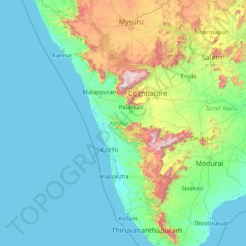
Nome: Mapa topográfico Kerala, altitude, relevo.
Local: Kerala, India (8.29353 74.86407 12.79606 77.41236)
Altitude média: 251 m
Altitude mínima: -4 m
Altitude máxima: 2.557 m
Outros mapas topográficos
Clique em um mapa para visualizar sua topografia, sua altitude e seu relevo.


Shimla
Shimla is on the south-western ranges of the Himalayas at 31°37′N 77°06′E / 31.61°N 77.10°E / 31.61; 77.10. It has an average altitude of 2,206 metres (7,238 ft) above mean sea level and extends along a ridge with seven spurs. The city stretches nearly 9.2 kilometres (5.7 mi) from east to west.
Altitude média: 1.557 m

Maharashtra
Maharashtra is the third largest state by area in India. The Western Ghats better known as Sahyadri, are a hilly range running parallel to the coast, at an average elevation of 1,200 metres (4,000 ft). Kalsubai, a peak in the Sahyadris, near Nashik city is the highest elevated point in Maharashtra. To the west…
Altitude média: 478 m

Mangaluru
India > Karnataka > Mangaluru taluk
Mangalore is also the administrative headquarters of the Dakshina Kannada district; it is a commercial, industrial, educational, healthcare, and startup hub. The city's international airport is the second-largest and second-busiest airport in Karnataka. Mangalore City Corporation is responsible for the civic…
Altitude média: 25 m

Aluva
Aluva Railway Station (IR Code: AWY) is a grade-A railway station in Kerala, and is the third busiest railway station in Kochi after Ernakulam Junction railway station and Ernakulam Town railway station. All passenger and express trains bound to southern Kerala have a stop at it. People travelling from the…
Altitude média: 11 m
Secunderabad
Situated in the North of Hyderabad at 17°27′N 78°30′E / 17.45°N 78.5°E / 17.45; 78.5., Secunderabad lies on the northern part of the Deccan Plateau. Secunderabad has an average elevation of 543 metres (1781 ft). Most of the area has a rocky terrain and some areas are hilly.
Altitude média: 544 m

Prayagraj
India > Uttar Pradesh > Allahabad
Prayagraj's elevation is over 90 m (295 ft) above sea level. The old part of the city, at the south of Prayagraj Junction railway station, consists of neighbourhoods like Chowk, Johnstongunj, Dariyabad, Khuldabad and many more. In the north of the Railway Station, the new city consists of neighbourhoods like…
Altitude média: 91 m
Guwahati
Professor Abani Kumar Bhagawati of Gauhati University stated that since before there were sufficient wetlands to absorb rainwater and channels to carry excess water to the Brahmaputra, the city did not experience floods. However, human interference has disrupted the natural topography, leading to the current…
Altitude média: 113 m






Faridkot
India > Punjab > Faridkot Tahsil
The average elevation is 196 metres (643 ft). The town is located on the Punjab Plains, which in a macro regional context forms a part of greater Satluj Ganga plain. It is a low-lying flat area. The surface of the district is depositional plain which was formed by alleviation by the rivers flowing in these…
Altitude média: 204 m



Leh
Leh (/ˈlɛ/) (Ladakhi: གླེ) is the joint capital and largest city of Ladakh, a union territory of India. Leh, located in the Leh district, was also the historical capital of the Kingdom of Ladakh, the seat of which was in the Leh Palace, the former residence of the royal family of Ladakh, built in the…
Altitude média: 4.294 m
Dwarka
India > Gujarat > Okhamandal Taluka
Considered a holy city, Dwarka is well known for its temples and as a pilgrimage centre for Hindus. The Dwarakadhisa Temple, also called Jagat Mandir, located in the heart of Dwarka, is a Vaishnava temple. It was built by Raja Jagat Singh Rathore, hence it is called Jagat Mandir. The temple, facing west, is at…
Altitude média: 3 m



Madanapalle
India > Andhra Pradesh > Madanapalle
It is located at an average elevation of 695 m (2,280 ft) above mean sea level.
Altitude média: 727 m
Varanasi
India > Uttar Pradesh > Sadar
Varanasi is located at an elevation of 80.71 metres (264.8 ft) in the centre of the Ganges valley of North India, in the Eastern part of the state of Uttar Pradesh, along the left crescent-shaped bank of the Ganges, averaging between 15 metres (50 ft) and 21 metres (70 ft) above the river. The city is the…
Altitude média: 77 m
Vadodara
India > Gujarat > Vadodara Rural Taluka
Vadodara is located at 22°18′N 73°11′E / 22.30°N 73.19°E / 22.30; 73.19 in western India at an elevation of 39 metres (128 ft). It is the tenth-largest city in India with an area of 400 square kilometres (150 sq mi) and a population of 3.5 million, according to the 2010–11 census. The city…
Altitude média: 36 m
Dehradun
India > Uttarakhand > Dehradun
The city of Dehradun mainly lies in Doon Valley and is at a varying height from 410 m (1,350 ft) in Clement Town to above 700 m (2,300 ft) at Malsi which is 15 km (9.3 mi) from the city. However, the average elevation is 450 m (1,480 ft) above sea level. Malsi is the starting point of Lesser Himalayan Range…
Altitude média: 904 m
Singtam
India > Sikkim > Gangtok subdivision
Singtam is located at 27°09′N 88°23′E / 27.15°N 88.38°E / 27.15; 88.38. It has an average elevation of 1396 feet. As the town lies on the bank of two rivers River Teesta and Ranikhola, during Monsoon especially from June to September the volume of both the rivers increases heavily, as a result…
Altitude média: 894 m


Patna
India > Bihar > Patna Rural
Patna is on the southern bank of the river Ganges. The total area of Patna is 250 km2 (97 sq mi). The municipal area constitutes 109.218 km2 (42.169 sq mi). The suburban area covers 140.782 km2 (54.356 sq mi). It has an average elevation of 53 m (174 ft). A characteristic feature of the geography of Patna is…
Altitude média: 51 m








Alangulam
India > Tamil Nadu > Alangulam
Alangulam is located at 8°52′N 77°30′E / 8.87°N 77.5°E / 8.87; 77.5. It is situated at an average elevation of 127 metres (416 feet).
Altitude média: 120 m


Karimpur
India > West Bengal > Karimpur-I
Karimpur is located at 23°58′N 88°37′E / 23.97°N 88.62°E / 23.97; 88.62. It has an average elevation of 15 metres (49 ft). It is 183 km (114 mi) from Kolkata and is located at the bank of the River Jalangi.
Altitude média: 18 m


Bardhaman
India > West Bengal > Burdwan - I
The region has an average elevation of 40 metres (131 ft). The city is situated 1100 km from New Delhi and a little less than 100 km north-west of Kolkata on the Grand Trunk Road (National Highway 19) and Eastern Railway. The chief rivers are the Damodar and the Banka.
Altitude média: 31 m



Leh
Leh (/ˈlɛ/) (Ladakhi: གླེ) is the joint capital and largest city of Ladakh, a union territory of India. Leh, located in the Leh district, was also the historical capital of the Kingdom of Ladakh, the seat of which was in the Leh Palace, the former residence of the royal family of Ladakh, built in the…
Altitude média: 4.294 m
Sultan Bathery
India > Kerala > Sulthanbathery
Sulthan Bathery is located at 11°40′N 76°17′E / 11.67°N 76.28°E / 11.67; 76.28. It has an average elevation of 907 m (2,976 ft).
Altitude média: 876 m





Vijayawada
India > Andhra Pradesh > Vijayawada (Urban)
Vijayawada lies on the banks of Krishna river, covered by hills and canals. and at an altitude of 11 m (36 ft) above sea level. Three canals originating from the north side of the Prakasam Barrage reservoir — Eluru, Bandar, and Ryves — flow through the city.
Altitude média: 37 m
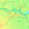
Patna
India > Bihar > Patna Rural
Patna is on the southern bank of the river Ganges. The total area of Patna is 250 km2 (97 sq mi). Of this, the municipal area constitutes 109.218 km2 (42.169 sq mi). The suburban area covers 140.782 km2 (54.356 sq mi). It has an average elevation of 53 m (174 ft). A characteristic feature of the geography of…
Altitude média: 51 m
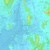
Navi Mumbai
India > Maharashtra > Thane > Navi Mumbai
Navi Mumbai (Marathi pronunciation: , also known by its former name New Bombay), is a planned city off the west coast of the Indian state of Maharashtra in Konkan division. The city is divided into two parts, North Navi Mumbai and South Navi Mumbai, for the individual development of Panvel Mega City, which…
Altitude média: 30 m
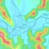
Mahad
India > Maharashtra > Mahad Taluka
Several disasters like floods and landslides have continuously devastated markets and old houses, specifically classic Konkani-styled architecture, causing great loss of life. This is primarily due to lower elevation of the city compared to surrounding areas and being surrounded by rivers on all sides, making…
Altitude média: 75 m