

Mapa topográfico Anamalai
Clique no mapa para exibir a altitude.
Sobre este mapa

Nome: Mapa topográfico Anamalai, altitude, relevo.
Local: Anamalai, Devikulam, Idukki, Kerala, India (10.31069 77.09083 10.31388 77.09329)
Altitude média: 2.023 m
Altitude mínima: 1.749 m
Altitude máxima: 2.263 m
Outros mapas topográficos
Clique em um mapa para visualizar sua topografia, sua altitude e seu relevo.
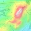
Western Ghats
The range starts near south of the Tapti river and runs approximately 1,600 km (990 mi) through the states of Gujarat, Maharashtra, Karnataka, Goa, Kerala and Tamil Nadu ending at Marunthuvazh Malai, Swamithope near the southern tip of India. These hills cover 160,000 km2 (62,000 sq mi) and form the catchment…
Altitude média: 2.225 m
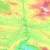
Western Ghats
The range starts near south of the Tapti river and runs approximately 1,600 km (990 mi) through the states of Gujarat, Maharashtra, Karnataka, Goa, Kerala and Tamil Nadu ending at Marunthuvazh Malai near the southern tip of India. These hills cover 160,000 km2 (62,000 sq mi) and form the catchment area for…
Altitude média: 2.225 m


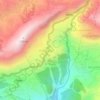
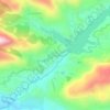


Anamudi
Anamudi ("Elephant head") is a mountain located in Ernakulam district and Idukki district of the Indian state of Kerala. With an elevation of 2,695 metres (8,842 ft) and a topographic prominence of 2,479 metres (8,133 ft), it is the highest peak in the Western Ghats and in South India.
Altitude média: 2.204 m



Adimali
Adimali generally has a cool climate throughout the year, typical of the higher altitudes, though not as cold as Munnar. Temperatures rarely exceed 26 degrees and never drop below 10 degrees as it usually stays around 17-24 degrees. December and January are cooler than other months. Adimali is a place with…
Altitude média: 786 m


Marayoor
Ezhuthu Guha rock paintings are sited in the Koodakavu Sandalwood Reserve Forest at Marayur in the Marayur Panchayat at an elevation of 1000 meters above mean sea level. More or less 90 painted motifs can be seen here. However, as the place is the most famous rock art site in Kerala, it attracts a large number…
Altitude média: 1.205 m


Western Ghats
Geologic evidence indicates that the mountains were formed during the break-up of the supercontinent of Gondwana. The mountains arose along the west coast of India somewhere in the late Jurassic and early Cretaceous periods when India separated from the African continent. The mountains can be roughly divided…
Altitude média: 2.225 m
Adimali
Adimaly generally has a cool climate throughout the year, typical of the higher altitudes, though not as cold as Munnar. Temperatures rarely exceed 26 degrees and never drop below 10 degrees as it usually stays around 17-24 degrees. December and January are cooler than other months. Adimaly is a place with…
Altitude média: 786 m
Western Ghats
Geologic evidence indicates that the mountains were formed during the break-up of the supercontinent of Gondwana. The mountains came along the west coast of India somewhere in the late Jurassic and early Cretaceous periods when India separated from the African continent. The mountains can be roughly divided…
Altitude média: 2.225 m
Anamudi
Anamudi ("Elephant head", Malayalam: [aːnɐmuɖi]) is a mountain located in Ernakulam district and Idukki district of the Indian state of Kerala. With an elevation of 2,695 m (8,842 ft), it is the highest peak in the Western Ghats and in South India.
Altitude média: 2.209 m
Marayoor
Ezhuthu Guha rock paintings are sited in the Koodakavu Sandalwood Reserve Forest at Marayur in the Marayur Panchayat at an elevation of 1000 meters above mean sea level. More or less 90 painted motifs can be seen here. However, as the place is the most famous rock art site in Kerala, it attracts a large number…
Altitude média: 1.071 m
Western Ghats
Geologic evidence indicates that the mountains were formed during the break-up of the supercontinent of Gondwana. The mountains came along the west coast of India somewhere in the late Jurassic and early Cretaceous periods when India separated from the African continent. The mountains can be roughly divided…
Altitude média: 2.225 m
Adimali
Adimaly generally has a cool climate throughout the year, typical of the higher altitudes, though not as cold as Munnar. Temperatures rarely exceed 26 degrees and never drop below 10 degrees as it usually stays around 17-24 degrees. December and January are cooler than other months. Adimaly is a place with…
Altitude média: 786 m