Mapa topográfico Lauf
Clique no mapa para exibir a altitude.
Lauf
The geographical feature that provides the name to Lauf is the Laufbach stream. This body of water originates from the northwestern side of the Hornisgrinde, subsequently flowing past Glashütte and eventually reaching Lauf. Its rapid descent forms a distinctive feature of the local topography.
Sobre este mapa
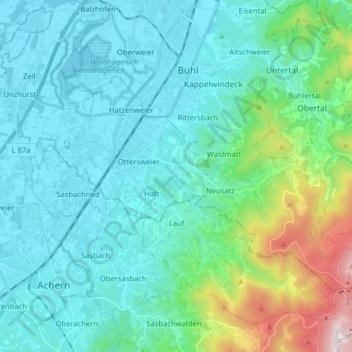
Nome: Mapa topográfico Lauf, altitude, relevo.
Altitude média: 297 m
Altitude mínima: 122 m
Altitude máxima: 1.136 m
Outros mapas topográficos
Clique em um mapa para visualizar sua topografia, sua altitude e seu relevo.