Geolocalizar

Mapa topográfico Lake D

Clique no mapa para exibir a altitude.

Sobre este mapa

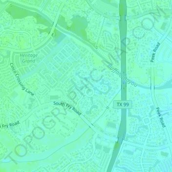
Nome: Mapa topográfico Lake D, altitude, relevo.

Local: Lake D, Avalon at Seven Meadows, Fort Bend County, Texas, United States (29.72234 -95.77975 29.72316 -95.77912)

Altitude média: 35 m

Altitude mínima: 31 m

Altitude máxima: 38 m

Outros mapas topográficos

Clique em um mapa para visualizar sua topografia, sua altitude e seu relevo.

Sienna

United States > Texas > Fort Bend County

Altitude média: 20 m

Katy

United States > Texas > Fort Bend County

Altitude média: 44 m

Sugar Land

United States > Texas > Fort Bend County

Sugar Land is located in northeast Fort Bend County, 20 miles (32 km) southwest of downtown Houston. It is bordered by Houston to the northeast, and by Stafford, Missouri City, and Meadows Place to the east. According to the United States Census Bureau, the city of Sugar Land has a total area of 34.0 square…

Altitude média: 24 m

Fulshear

United States > Texas > Fort Bend County

Altitude média: 37 m

Rosenberg

United States > Texas > Fort Bend County

Altitude média: 28 m

Kendleton

United States > Texas > Fort Bend County

Altitude média: 31 m

Paynes

United States > Texas > Fort Bend County > Sugar Land

Altitude média: 24 m

Guy

United States > Texas > Fort Bend County

Altitude média: 24 m

Needville

United States > Texas > Fort Bend County

Altitude média: 28 m

Oak Hill

United States > Texas > Fort Bend County

Altitude média: 29 m

Stafford

United States > Texas > Fort Bend County

Altitude média: 25 m

Katy

United States > Texas > Fort Bend County

Altitude média: 44 m

Katy

United States > Texas > Fort Bend County > Katy > Katy

Altitude média: 43 m

Rosenberg

United States > Texas > Fort Bend County

Altitude média: 28 m

Richmond

United States > Texas > Fort Bend County

Altitude média: 27 m

Pecan Grove

United States > Texas > Fort Bend County

Altitude média: 27 m

Stafford

United States > Texas > Fort Bend County

Altitude média: 25 m

Fresno

United States > Texas > Fort Bend County

Altitude média: 21 m

Rosenberg

United States > Texas > Fort Bend County

Altitude média: 28 m

Sugar Land

United States > Texas > Fort Bend County

Sugar Land is located in northeast Fort Bend County, 20 miles (32 km) southwest of downtown Houston. It is bordered by Houston to the northeast, and by Stafford, Missouri City, and Meadows Place to the east. According to the United States Census Bureau, the city of Sugar Land has a total area of 42.9 square…

Altitude média: 24 m

Cumings

United States > Texas > Fort Bend County > Rosenberg

Altitude média: 29 m

Fulshear

United States > Texas > Fort Bend County

Altitude média: 37 m

Thompsons

United States > Texas > Fort Bend County

Altitude média: 22 m

Orchard

United States > Texas > Fort Bend County

Altitude média: 38 m

Rosenberg

United States > Texas > Fort Bend County

Altitude média: 28 m

Duke

United States > Texas > Fort Bend County > Arcola

Altitude média: 20 m