
Faça uma doação
Mapa topográfico Lozano
Clique no mapa para exibir a altitude.
Faça uma doação
Sobre este mapa
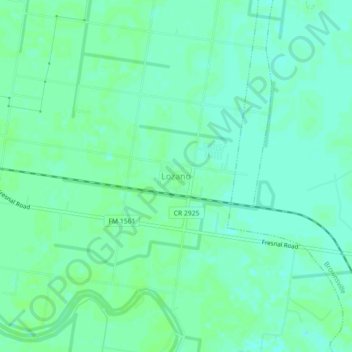
Nome: Mapa topográfico Lozano, altitude, relevo.
Local: Lozano, Cameron County, Texas, United States (26.16970 -97.56170 26.20970 -97.52170)
Altitude média: 10 m
Altitude mínima: 5 m
Altitude máxima: 12 m
Faça uma doação
Outros mapas topográficos
Clique em um mapa para visualizar sua topografia, sua altitude e seu relevo.
Starbase
United States > Texas > Cameron County
SpaceX conducted a groundbreaking ceremony on the new launch facility in September 2014, and soil preparation began in October 2015. The first tracking antenna was installed in August 2016, and the first propellant tank arrived in July 2018. In late 2018, construction ramped up considerably, and the site saw…
Altitude média: 2 m
Faça uma doação
Brownsville
United States > Texas > Cameron County
Soils are mostly of clay to silty clay loam texture, moderately alkaline (pH 8.2) to strongly alkaline (pH 8.5 and with a significant degree of salinity in many places; other types of soils present around the city include Cameron clay and sporadic amounts of Laredo silt loam. Due to Brownsville's proximity to…
Altitude média: 9 m
Faça uma doação
Starbase
United States > Texas > Cameron County
SpaceX conducted a groundbreaking ceremony on the new launch facility in September 2014, and soil preparation began in October 2015. The first tracking antenna was installed in August 2016, and the first propellant tank arrived in July 2018. In late 2018, construction ramped up considerably, and the site saw…
Altitude média: 2 m
Faça uma doação
Brownsville
United States > Texas > Cameron County
Soils are mostly of clay to silty clay loam texture, moderately alkaline (pH 8.2) to strongly alkaline (pH 8.5) and with a significant degree of salinity in many places; other types of soils present around the city include Cameron clay and sporadic amounts of Laredo silt loam. Due to Brownsville's proximity to…
Altitude média: 9 m
Faça uma doação
Faça uma doação