Mapa topográfico Iloilo
Clique no mapa para exibir a altitude.
Iloilo
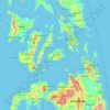
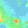
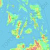
The province is divided into two distinct geographic regions; the highlands of the Central Panay Mountain Range on the western border and the lowland plains which account for a larger portion of the province. Small islands east of its northernmost tip also dot the Visayan Sea - of these, Pan de Azucar and Sicogon are well-known. Mount Baloy is the highest mountain in Iloilo with an elevation of 6,424 feet (1,958 m) above sea level, located on the triple border of Iloilo, Capiz, and Antique. Other peaks are Mount Llorente 4,409 ft. (1,344m), Mount Sansanan 4,219 ft. (1,286m), Mount Napulak 4,095 ft. (1,248 m), Mount Balabag 3,728 ft. (1,136m).
Sobre este mapa
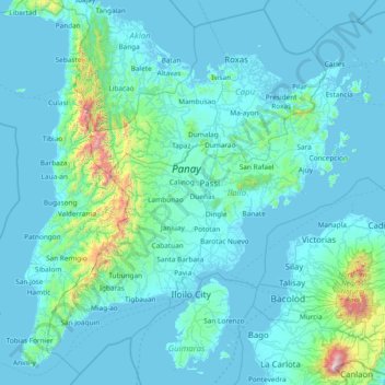
Nome: Mapa topográfico Iloilo, altitude, relevo.
Local: Iloilo, Western Visayas, Philippines (10.38720 122.01153 11.77391 123.51047)
Altitude média: 129 m
Altitude mínima: -2 m
Altitude máxima: 2.356 m
Outros mapas topográficos
Clique em um mapa para visualizar sua topografia, sua altitude e seu relevo.
Quezon City
Founded as a pueblo by Saint Pedro Bautista in 1590, San Francisco del Monte may be considered Quezon City's oldest district. The original land area of the old town of San Francisco del Monte was approximately2.5 square kilometres (1.0 sq mi) and covered parts of what is currently known as Project 7 and 8 and…
Altitude média: 57 m
Malolos
Malolos is relatively flat of about 0.81% to a gently sloping of 2.17%. The slope of the land descends towards west, southwest to southern direction. The highest land elevation is at about 6.0 meters above sea level while the lowest is only half a meter below sea level. A network of natural waterways and…
Altitude média: 6 m
Baguio
In 1903, Filipinos, Japanese and Chinese workers were hired to build Kennon Road, the first road directly connecting Baguio with the lowlands of La Union and Pangasinan. Before this, the only road to Benguet was Naguilian Road, and it was largely a horse trail at higher elevations. Camp John Hay was…
Altitude média: 881 m


Tagaytay
The southern and eastern portions of Tagaytay are covered by hills and mountains which is generally forests, pine trees and open grasslands. The city lies along Tagaytay Ridge, a ridge stretching about 32 kilometres (20 mi) from Mount Batulao in the west to Mount Sungay in the east with elevations averaging…
Altitude média: 229 m
Mandaluyong
Another claims that the Spaniards named the place based on the report of a navigator named Acapulco, who saw the rolling hills frequently being lashed at by daluyong (“big waves from the sea”). This seems to confirm traditional pre-Hispanic stories that giant waves from the sea would meet the adjoining…
Altitude média: 33 m


Valenzuela
The highest elevation point is 38 meters (125 ft) above sea level. Having a surface gradient of 0.55% and a gentle slope, hilly landscape is located in the industrial section of the city in Canumay. The average elevation point is 2 meters (6.6 ft) above sea level.
Altitude média: 24 m
Tagum
One of the significant accomplishments of the officialdom of Tagum during the 1990s was its elevation from a second to the first-class municipality. This opened a gateway to increase its financial resources through the Internal Revenue Allocation (IRA) from the national government and local revenues. This was…
Altitude média: 103 m






San Juan
The topography of the town is characterized by hilly and mountainous terrain that gradually rises eastward from its coastal plains along the foothills of the Cordillera Central. The town is also traversed by several creeks and rivers, with the Baroro River being the most prominent.
Altitude média: 21 m


Jones
Jones is primarily an agricultural municipality best suited for the intensive production of rice and corn as evidence by its topographic map which shows that 73% of the agricultural area of 16,848 hectares is under 0-3 slope category.
Altitude média: 99 m
General Tinio
Farming is the livelihood of majority of the residents. Even though located at the foot of the Sierra Madre Mountain Ridges, the topography is generally plain ideal to agricultural products such as palay and vegetables. A number of poultry broiler contract growers are located in the municipality. Other…
Altitude média: 54 m
Claveria
Philippines > Misamis Oriental
The town has a generally rugged topography, characterized by gently rolling hills and mountains with cliffs and escarpments. The soil is classified as Jasaan clay, with a deep soil profile (greater than 1 m) and rapid drainage. It is generally acidic (pH 3.9 to 5.2), with low cation exchange capacity (CEC),…
Altitude média: 663 m
Daraga
67.3% of the total municipal land area has a predominantly low elevation of up to 100 metres (330 ft). The surface terrain is generally characterized by combination of level to nearly level areas, gentle to undulating areas and undulating to rolling areas.
Altitude média: 76 m
Sorsogon City
Sorsogon City covers a land area of 31,292 hectares (120.82 sq mi). It is at the southernmost tip of the Bicol Peninsula and of Luzon Island. The city is bounded by Castilla in the west, Manito in the northwest, Albay Gulf in the north, Prieto Diaz in the east, Gubat in the southeast, Casiguran in the…
Altitude média: 89 m





Dasmariñas
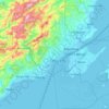
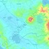
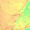
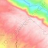
Dasmariñas is partly lowland and partly hilly. The Poblacion itself is elevated. From an elevation of 80 meters (260 ft) at the Poblacion, the land rises to 250 meters (820 ft) towards Silang. Generally, land near rivers and creeks are rugged. Dasmariñas is outside the typhoon belt and has no fault line…
Altitude média: 97 m