Geolocalizar
👉 Easily get elevation data in JSON, GeoTIFF and KML formats using Elevation API
Obrigado por apoiar este site ❤️
Faça uma doação

Mapa topográfico Milltown

Clique no mapa para exibir a altitude.

👉 Easily get elevation data in JSON, GeoTIFF and KML formats using Elevation API
Obrigado por apoiar este site ❤️
Faça uma doação

Sobre este mapa

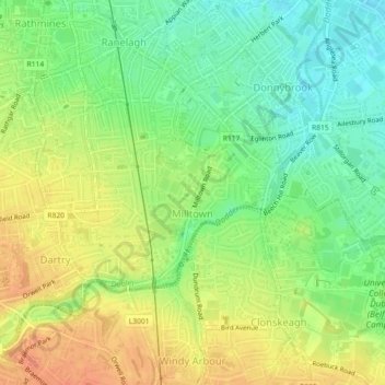
Nome: Mapa topográfico Milltown, altitude, relevo.

Local: Milltown, Rathmines East B Ward 1986, Dublin, County Dublin, Leinster, Ireland (53.30798 -6.25978 53.32127 -6.24083)

Altitude média: 27 m

Altitude mínima: 5 m

Altitude máxima: 48 m

Outros mapas topográficos

Clique em um mapa para visualizar sua topografia, sua altitude e seu relevo.

Dublin Castle

Ireland > County Dublin > Dublin

The Poddle was diverted into the city through archways where the walls adjoined the castle, artificially flooding the moat of the fortress's city elevations. One of these archways and part of the wall survive buried underneath the 18th-century buildings, and are open for public viewing.

Altitude média: 16 m

Iveagh Gardens

Ireland > County Dublin > Dublin

Altitude média: 17 m

Griffith Park

Ireland > County Dublin > Dublin

Altitude média: 26 m

Tolka Valley Park

Ireland > County Dublin > Dublin

Altitude média: 44 m

St Anne's Park

Ireland > County Dublin > Dublin

Altitude média: 13 m