
Faça uma doação
Mapa topográfico Galveston
Clique no mapa para exibir a altitude.
Faça uma doação
Galveston
On September 8, 1900, the island was struck by a devastating hurricane. This event holds the record as the United States' deadliest natural disaster. The city was devastated, and an estimated 6,000 to 8,000 people on the island were killed. Following the storm, a 10-mile (16 km) long, 17 foot (5.2 m) high seawall was built to protect the city from floods and hurricane storm surges. A team of engineers including Henry Martyn Robert (Robert's Rules of Order) designed the plan to raise much of the existing city to a sufficient elevation behind a seawall so that confidence in the city could be maintained.
Faça uma doação
Sobre este mapa
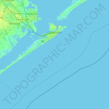
Nome: Mapa topográfico Galveston, altitude, relevo.
Local: Galveston, Galveston County, Texas, United States (28.99634 -95.12994 29.39940 -94.52566)
Altitude média: 1 m
Altitude mínima: -7 m
Altitude máxima: 15 m
Faça uma doação
Outros mapas topográficos
Clique em um mapa para visualizar sua topografia, sua altitude e seu relevo.
Faça uma doação
San Luis Pass
United States > Texas > Galveston County > Galveston
Tides cause daily variations in topography, and occasionally, storms more drastically change the topography of the pass.
Altitude média: 0 m
Faça uma doação
Bacliff
United States > Texas > Galveston County
After Hurricane Ike hit Texas in September 2008, Galveston County officials offered a debris removal program to residents in unincorporated areas, including Bacliff. Flooding from hurricane Ike was minimized due in part to Bacliff's relatively high elevation of 16 feet.
Altitude média: 4 m
Faça uma doação