
Faça uma doação
Mapa topográfico Lake Hart
Clique no mapa para exibir a altitude.
Faça uma doação
Sobre este mapa
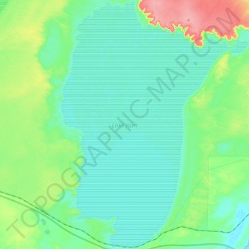
Nome: Mapa topográfico Lake Hart, altitude, relevo.
Altitude média: 115 m
Altitude mínima: 92 m
Altitude máxima: 188 m
Faça uma doação
Outros mapas topográficos
Clique em um mapa para visualizar sua topografia, sua altitude e seu relevo.
Faça uma doação
Bunkers Conservation Reserve
Australia > South Australia > Pastoral Unincorporated Area
Altitude média: 494 m
Faça uma doação
Dullingari
Australia > South Australia > Pastoral Unincorporated Area > Innamincka
Altitude média: 89 m
Faça uma doação
Wabma Kadarbu Mound Springs Conservation Park
Australia > South Australia > Pastoral Unincorporated Area
Altitude média: 18 m
Nullabor Plain
Australia > South Australia > Pastoral Unincorporated Area
One theory is that the whole area was uplifted by crustal movements in the Miocene, and since then, erosion by wind and rain has reduced its thickness. The plain has most likely never had any major defining topographic features, resulting in the extremely flat terrain across the plain today.
Altitude média: 117 m
Faça uma doação
Faça uma doação
Ikara-Flinders Ranges National Park
Australia > South Australia > Pastoral Unincorporated Area
Altitude média: 430 m
Faça uma doação
Faça uma doação
Faça uma doação
Faça uma doação
Oodnadatta
Australia > South Australia > Pastoral Unincorporated Area
Oodnadatta is a small, remote outback town and locality in the Australian state of South Australia, located 1043 kilometres (648 miles) north-north-west of the state capital of Adelaide by road or 873 km (542 mi) direct, at an altitude of 112 metres (367 feet). The unsealed Oodnadatta Track, an outback road…
Altitude média: 130 m
Faça uma doação
Faça uma doação
Malkumba-Coongie Lakes National Park
Australia > South Australia > Pastoral Unincorporated Area > Innamincka
Altitude média: 36 m
Faça uma doação
Fowlers Bay
Australia > South Australia > Pastoral Unincorporated Area > Fowlers Bay
Altitude média: 3 m
Faça uma doação
Mungerannie
Australia > South Australia > Pastoral Unincorporated Area > Mungerannie
Altitude média: 59 m
Leigh Creek
Australia > South Australia > Pastoral Unincorporated Area > Leigh Creek
Altitude média: 267 m
Lyndhurst
Australia > South Australia > Pastoral Unincorporated Area > Lyndhurst
Altitude média: 133 m
Faça uma doação
Faça uma doação
Faça uma doação
Lake Acraman
Australia > South Australia > Pastoral Unincorporated Area
Oblique Landsat image of Lake Acraman draped over digital elevation model (10x vertical exaggeration), looking east towards the Flinders Ranges where ejecta has been found; screen capture from NASA World Wind.
Altitude média: 147 m
Far West Coast Marine Park
Australia > South Australia > Pastoral Unincorporated Area
Altitude média: 66 m
Ironstone Hill Conservation Park
Australia > South Australia > Pastoral Unincorporated Area
Altitude média: 196 m
Faça uma doação
Faça uma doação
Faça uma doação
Nilpena Ediacara National Park
Australia > South Australia > Pastoral Unincorporated Area
Altitude média: 84 m
Faça uma doação
Faça uma doação