
Faça uma doação
Mapa topográfico Battery Park
Clique no mapa para exibir a altitude.
Faça uma doação
Sobre este mapa
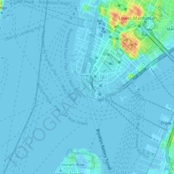
Nome: Mapa topográfico Battery Park, altitude, relevo.
Altitude média: 3 m
Altitude mínima: -3 m
Altitude máxima: 47 m
Faça uma doação
Outros mapas topográficos
Clique em um mapa para visualizar sua topografia, sua altitude e seu relevo.
Highbridge Park
United States > New York > New York County > New York
The north and south wings respectively contain the women's and men's locker rooms and are nearly identical. Both have nine windows separated by eight brick pilasters. The stone capitals of the pilasters line up with the lintels of the windows. Ramps lead from the extreme ends of each wing. The ground slopes…
Altitude média: 30 m
Fort Tryon Park
United States > New York > New York County > New York
In preparation for converting the land into a city park, Rockefeller hired the Olmsted Brothers firm, particularly Frederick Law Olmsted Jr., son of the designer of Central Park. Olmsted's design capitalized on the topography to reveal sweeping vistas of the Hudson River and the Palisades. Olmsted Jr. was…
Altitude média: 20 m
Faça uma doação