
Mapa topográfico Lincoln
Clique no mapa para exibir a altitude.
Sobre este mapa
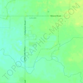
Nome: Mapa topográfico Lincoln, altitude, relevo.
Local: Lincoln, Placer County, California, United States (38.85134 -121.34937 38.86811 -121.33542)
Altitude média: 34 m
Altitude mínima: 26 m
Altitude máxima: 41 m
Outros mapas topográficos
Clique em um mapa para visualizar sua topografia, sua altitude e seu relevo.
Lake Tahoe
United States > California > Placer County
Lake Tahoe is renowned for its dramatic topography, characterized by rugged mountain ranges and deep, crystal-clear waters. Nestled in the Sierra Nevada, the lake itself lies at an elevation of approximately 6,225 feet (1,897 meters) and spans about 22 miles (35 kilometers) in length and 12 miles (19…
Altitude média: 2.077 m
Roseville
United States > California > Placer County
Roseville has a hot-summer Mediterranean climate that is characterized by cool, wet, usually snowless winters and hot, dry summers (Köppen Csa). The wet season is generally October through April. Because Roseville is east of Sacramento and at a higher elevation, it receives slightly more rainfall. Average…
Altitude média: 67 m
Folsom Lake State Recreation Area
United States > California > Placer County > Auburn
Avery's Pond is located near Rattlesnake Bar, north of the Rattlesnake Bar Equestrian Assembly Area. It can be accessed by parking at Rattlesnake Bar and walking 1.1 miles to the sites. There are 2 Sites and each holds 8 people. There are no water or garbage service and no dogs or fires allowed. It is commonly…
Altitude média: 201 m
Colfax
United States > California > Placer County
Colfax has a hot-summer Mediterranean climate (Köppen Csa) that is characterized by cool, wet winters and hot, dry summers. Summers can be quite hot, especially in the months of July and August where temperatures easily reach 90 °F (32 °C), with plenty of sunshine. Winters, on the other hand, are quite cool…
Altitude média: 685 m
Donner Peak
United States > California > Placer County
Donner Peak is an 8,019-foot-elevation (2,444-meter) summit in Placer County, California, United States.
Altitude média: 2.171 m
Colfax
United States > California > Placer County
Colfax has a hot-summer Mediterranean climate (Köppen Csa) that is characterized by cool, wet winters and hot, dry summers. Summers can be quite hot, especially in the months of July and August where temperatures easily reach 90 °F (32 °C), with plenty of sunshine. Winters, on the other hand, are quite cool…
Altitude média: 685 m
Roseville
United States > California > Placer County
Roseville has a hot-summer Mediterranean climate that is characterized by cool, wet, usually snowless winters and hot, dry summers (Köppen Csa). The wet season is generally October through April. Because Roseville is east of Sacramento and at a higher elevation, it receives slightly more rainfall. Average…
Altitude média: 67 m
Carnelian Bay
United States > California > Placer County
For statistical purposes, the United States Census Bureau has defined Carnelian Bay as a census-designated place (CDP). The census definition of the area may not precisely correspond to local understanding of the area with the same name. The population was 524 at the 2010 census. The elevation is 6,325 feet…
Altitude média: 1.977 m
Roseville
United States > California > Placer County
The wet season is generally October through April. Because Roseville is east of Sacramento and at a higher elevation, it receives slightly more rainfall. The dry season lasts from June to October; similar to other Central Valley cities, temperatures can be extremely hot in the summer (routinely peaking above…
Altitude média: 67 m
Lake Tahoe
United States > California > Placer County
Lake Tahoe has a dry-summer continental climate (Dsb in the Köppen climate classification), featuring warm, dry summers and chilly winters with regular snowfall. Mean annual precipitation ranges from over 55 inches (1440 mm) for watersheds on the west side of the basin to about 26 inches (660 mm) near the…
Altitude média: 2.077 m
Roseville
United States > California > Placer County
Roseville has a hot-summer Mediterranean climate that is characterized by cool, wet, usually snowless winters and hot, dry summers (Köppen Csa). The wet season is generally October through April. Because Roseville is east of Sacramento and at a higher elevation, it receives slightly more rainfall. Average…
Altitude média: 67 m
Roseville
United States > California > Placer County
The wet season is generally October through April. Because Roseville is east of Sacramento and at a higher elevation, it receives slightly more rainfall. The dry season lasts from June to October; similar to other Central Valley cities, temperatures can be extremely hot in the summer (routinely peaking above…
Altitude média: 67 m
Blue Canyon
United States > California > Placer County
Blue Canyon (also, Blue Cañon) is an unincorporated community in Placer County, California. Blue Canyon is located 4 miles (6.4 km) southwest of Emigrant Gap. It lies at an elevation of 4695 feet (1431 m).
Altitude média: 1.452 m