
Mapa topográfico Balvaird Castle
Clique no mapa para exibir a altitude.
Sobre este mapa
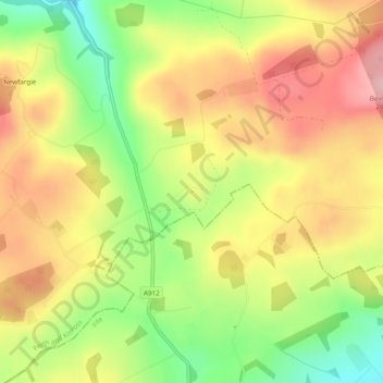
Nome: Mapa topográfico Balvaird Castle, altitude, relevo.
Altitude média: 178 m
Altitude mínima: 87 m
Altitude máxima: 257 m
Outros mapas topográficos
Clique em um mapa para visualizar sua topografia, sua altitude e seu relevo.
Schiehallion
United Kingdom > Scotland > Perth and Kinross
Schiehallion lies between Loch Tay, Loch Rannoch and Loch Tummel, about 10 miles (16 kilometres) to the west-north-west of Aberfeldy in Perthshire. The mountain, with an elevation of 1,083 metres (3,553 ft), is isolated from other peaks and has an almost perfectly conical shape from the west. The view of the…
Altitude média: 652 m
Loch Tay
United Kingdom > Scotland > Perth and Kinross > Kenmore
In the Early Medieval period people began to cultivate the higher elevations of the hills around the loch. The Macnabs, the Menzies, the Drummonds, the Napiers, the Haldanes, the MacGregors and the Robertsons of Carwhin and Strowan all owned land around the loch but little remains of their possible…
Altitude média: 460 m
Ben Vorlich
United Kingdom > Scotland > Perth and Kinross
Due to its prominence when seen from the lower ground of the Central Belt, Ben Vorlich is one of the most commonly seen of Munros, Scotland's peaks of at least 3,000 ft (914.4 m) elevation. It lies in an area of land bounded to the north by Loch Earn and to the west by Loch Lubnaig. The town of Callander lies…
Altitude média: 646 m
Dupplin Castle
United Kingdom > Scotland > Perth and Kinross > Forteviot > Aberdalgie
Altitude média: 74 m
Alyth
United Kingdom > Scotland > Perth and Kinross
To the northeast of the town a hill fort, possibly of Pictish date or earlier, stands atop Barry (or 'barrow') Hill. It is considered to be one of the best preserved examples of an enclosed hilltop settlement in Scotland. The remains consist of massive collapsed stone ramparts that take advantage of the…
Altitude média: 125 m
Easter Balgedie
United Kingdom > Scotland > Perth and Kinross > Kinnesswood > Easter Balgedie
Altitude média: 189 m
Loch Leven National Nature Reserve
United Kingdom > Scotland > Perth and Kinross > Kinross
Altitude média: 119 m
Craig Varr
United Kingdom > Scotland > Perth and Kinross > Kinloch Rannoch > Drumchastle
Altitude média: 370 m
Ben Lawers
United Kingdom > Scotland > Perth and Kinross
Due to its high elevation and underlying geology, Ben Lawers is home to an exceptionally rich selection of arctic-alpine plant species and habitats. Since 1964, it has been designated as a National Nature Reserve (NNR).
Altitude média: 849 m