
Mapa topográfico Linge
Mapa interativo
Clique no mapa para exibir a altitude.
Sobre este mapa
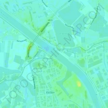
Nome: Mapa topográfico Linge, altitude, relevo.
Local: Linge, Tiel, Gelderland, Nederland, 4011LX, Nederland (51.91872 5.43332 51.92041 5.43569)
Altitude média: 5 m
Altitude mínima: 1 m
Altitude máxima: 17 m
Outros mapas topográficos
Clique em um mapa para visualizar sua topografia, sua altitude e seu relevo.
Kerk Avezaath
Nederland > Gelderland > Tiel
Kerk Avezaath, Tiel, Gelderland, Nederland
Altitude média: 6 m
Dode Linge
Nederland > Gelderland > Tiel
Dode Linge, Rivierenlandlaan, Westroijen, Tiel, Gelderland, Nederland, 4003JK, Nederland
Altitude média: 6 m
Kapel Avezaath
Nederland > Gelderland > Tiel
Kapel Avezaath, Tiel, Gelderland, Nederland
Altitude média: 5 m
Zennewijnen
Nederland > Gelderland > Tiel > Zennewijnen
Zennewijnen, Tiel, Gelderland, Nederland
Altitude média: 6 m