
Obrigado por apoiar este site ❤️
Faça uma doação
Faça uma doação
Mapa topográfico Rendon
Clique no mapa para exibir a altitude.
Obrigado por apoiar este site ❤️
Faça uma doação
Faça uma doação
Sobre este mapa
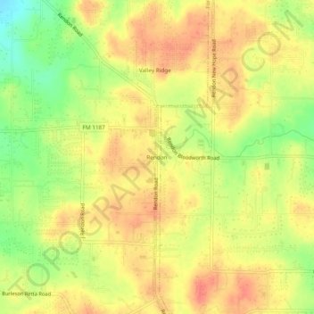
Nome: Mapa topográfico Rendon, altitude, relevo.
Local: Rendon, Fort Worth, Tarrant County, Texas, United States (32.55625 -97.26140 32.59625 -97.22140)
Altitude média: 221 m
Altitude mínima: 189 m
Altitude máxima: 240 m
Obrigado por apoiar este site ❤️
Faça uma doação
Faça uma doação
Outros mapas topográficos
Clique em um mapa para visualizar sua topografia, sua altitude e seu relevo.
Benbrook Lake
United States > Texas > Tarrant County > Fort Worth
Construction of Benbrook dam began in May 1947, and was practically completed when floodgates were closed and deliberate impoundment was begun in September 1952. The cost to build the lake was $14.5 million ($112 million in 2007 dollars). The rolled-earth embankment is 9,130 feet (2,783 m) in length, including…
Altitude média: 228 m
Obrigado por apoiar este site ❤️
Faça uma doação
Faça uma doação