

Mapas topográficos Sondrio
Clique em um mapa para visualizar sua topografia, sua altitude e seu relevo.

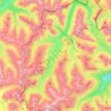
Livigno
Only three roads lead to the town. Two link to Switzerland, one through the Forcola di Livigno, elevation 2,315 m (7,595 ft) and open in summer only, and the second through the Munt la Schera Tunnel. The third road connects to other parts of Italy through the Foscagno Pass, elevation 2,291 m (7,516 ft).
Altitude média: 2.388 m