
Mapa topográfico Wernigerode
Clique no mapa para exibir a altitude.
Sobre este mapa
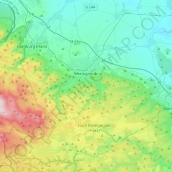
Nome: Mapa topográfico Wernigerode, altitude, relevo.
Local: Wernigerode, Landkreis Harz, Saxony-Anhalt, Germany (51.75220 10.57385 51.88704 10.90049)
Altitude média: 381 m
Altitude mínima: 139 m
Altitude máxima: 1.062 m
Outros mapas topográficos
Clique em um mapa para visualizar sua topografia, sua altitude e seu relevo.
Brocken
Germany > Saxony-Anhalt > Landkreis Harz > Wernigerode
The Brocken (German pronunciation: [ˈbʁɔkn̩] ), also sometimes referred to as the Blocksberg, is a 1,141 m (3,743 ft) mountain near Schierke in the German state of Saxony-Anhalt, between the rivers Weser and Elbe. The highest peak in the Harz mountain range, and in Northern Germany, it is subalpine, yet…
Altitude média: 963 m