
Mapa topográfico Crane Hill
Mapa interativo
Clique no mapa para exibir a altitude.
Sobre este mapa
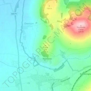
Nome: Mapa topográfico Crane Hill, altitude, relevo.
Altitude média: 77 m
Altitude mínima: 28 m
Altitude máxima: 221 m
Outros mapas topográficos
Clique em um mapa para visualizar sua topografia, sua altitude e seu relevo.
Bishop's Cleeve
United Kingdom > England > Gloucestershire > Tewkesbury > Gotherington
Bishop's Cleeve, Gotherington, Tewkesbury, Gloucestershire, England, United Kingdom
Altitude média: 51 m
Snowshill
United Kingdom > England > Gloucestershire > Tewkesbury
Snowshill, Tewkesbury, Gloucestershire, England, WR12 7JX, United Kingdom
Altitude média: 246 m
Tewkesbury
United Kingdom > England > Gloucestershire > Tewkesbury
Tewkesbury, Gloucestershire, South West England, England, United Kingdom
Altitude média: 18 m