

Mapa topográfico Morgan Hill
Clique no mapa para exibir a altitude.
Morgan Hill
Morgan Hill is approximately 24 mi (39 km) south of downtown San Jose, 13 mi (21 km) north of Gilroy, and 15 mi (24 km) inland from the Pacific coast. Lying in a roughly 4-mile-wide (6 km) southern extension of the Santa Clara Valley, it is bounded by the Santa Cruz Mountains to the west and the Diablo Range to the east. At the valley floor, Morgan Hill lies at an elevation of about 350 feet (107 m) above MSL.
Sobre este mapa
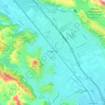
Nome: Mapa topográfico Morgan Hill, altitude, relevo.
Altitude média: 153 m
Altitude mínima: 78 m
Altitude máxima: 502 m
Outros mapas topográficos
Clique em um mapa para visualizar sua topografia, sua altitude e seu relevo.
