
Mapa topográfico Great Falls
Mapa interativo
Clique no mapa para exibir a altitude.
Great Falls
The rocks of the falls date to the late Precambrian and are about 750 million years old. The rocks are a resistant metamorphized schist, gneisses, metagraywackes, and metaconglomerates. The Falls formed the last time sea level dropped, during the Last Glacial Period about 35,000 years ago, causing the Potomac to downcut its valley. The river cascades over a series of 20-foot (6.1 m) falls, dropping a total of 76 feet (23 m) in elevation over a distance of less than 1 mile (1.6 km). As sea level rises again, the power of the falls will be reduced due to a shorter vertical drop and likewise downcutting will slow down. Should the ocean level ever exceed the height of the falls again, downcutting would reverse entirely with silt filling in the now-underwater falls.
Sobre este mapa
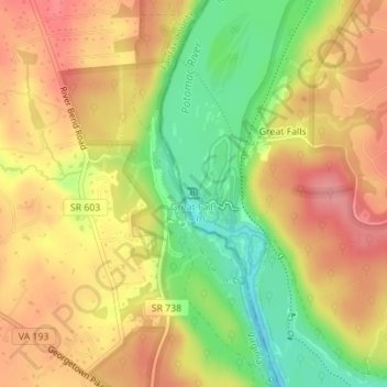
Nome: Mapa topográfico Great Falls, altitude, relevo.
Altitude média: 73 m
Altitude mínima: 17 m
Altitude máxima: 115 m