
Faça uma doação
Mapa topográfico Colorado Springs
Clique no mapa para exibir a altitude.
Faça uma doação
Colorado Springs
Snowfall is usually moderate and remains on the ground briefly because of direct sun, with the city receiving 38 inches (97 cm) per season, although the mountains to the west often receive in excess of triple that amount; March is the snowiest month in the region, both by total accumulation and number of days with measurable snowfall. In addition, 8 of the top 10 heaviest 24-hour snowfalls have occurred from March to May. Summers are warm, with July, the warmest month, averaging 70.9 °F (21.6 °C), and 18 days of 90 °F (32 °C)+ highs annually. Due to the high elevation and aridity, nights are usually relatively cool and rarely does the low remain above 70 °F (21 °C). Dry weather generally prevails, but brief afternoon thunderstorms are common, especially in July and August when the city receives the majority of its annual rainfall, due to the North American monsoon.
Faça uma doação
Sobre este mapa
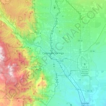
Nome: Mapa topográfico Colorado Springs, altitude, relevo.
Altitude média: 2.229 m
Altitude mínima: 1.678 m
Altitude máxima: 3.853 m
Faça uma doação
Outros mapas topográficos
Clique em um mapa para visualizar sua topografia, sua altitude e seu relevo.
Air Force Academy
United States > Colorado > El Paso County > Colorado Springs
The campus of the academy covers 18,455 acres (29 sq mi; 75 km2) on the east side of the Rampart Range of the Rocky Mountains, just north of Colorado Springs. Its elevation is normally given as 7,258 feet (2,212 m) above sea level, which is at the cadet area. The academy was designed by Skidmore, Owings and…
Altitude média: 2.158 m
Faça uma doação
Faça uma doação
Faça uma doação
Faça uma doação
Peterson AFB Parade Grounds
United States > Colorado > El Paso County > Colorado Springs
Altitude média: 1.899 m
North Cheyenne Cañon Park
United States > Colorado > El Paso County > Colorado Springs
Altitude média: 2.224 m
Faça uma doação