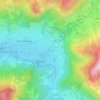
Mapa topográfico Weitnau
Clique no mapa para exibir a altitude.
Weitnau
• Argental Skilifte; Two ski lifts offer well-prepared pistes for beginners and seasoned skiers and snowboarders. The 500-metre-long family lift, a modern T-bar lift with a difference in altitude of 120 metres, was completely rebuilt in the early 2000s. In addition, there is a 100-metre beginners lift with a difference in altitude of 20 metres. Right next to the beginners lift, a short run is usually prepared for sledges and toboggans. The "Cafe Widdumstüble" provides food as well as hot and cold drinks. Weitnau's cross-country skiing network has its starting point here and is regularly tracked from here.
Sobre este mapa

Nome: Mapa topográfico Weitnau, altitude, relevo.
Altitude média: 887 m
Altitude mínima: 689 m
Altitude máxima: 1.236 m
Outros mapas topográficos
Clique em um mapa para visualizar sua topografia, sua altitude e seu relevo.

Weiherkopf
Germany > Bavaria > Landkreis Oberallgäu > Bolsterlang
In 18th century maps the mountain is described as the Veier; but, from 1940, in the topographical map of Fischen as the Weiher Kopf. "A pond [Weiher] from which the name might have been derived can no longer be identified". Steiner believes it is, however, entirely plausible that the mountain might once have…
Altitude média: 1.374 m

Immenstadt im Allgäu
Germany > Bavaria > Landkreis Oberallgäu > Immenstadt im Allgäu
Altitude média: 910 m