
Obrigado por apoiar este site ❤️
Faça uma doação
Faça uma doação
Mapa topográfico Avery
Clique no mapa para exibir a altitude.
Obrigado por apoiar este site ❤️
Faça uma doação
Faça uma doação
Sobre este mapa
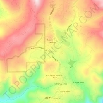
Nome: Mapa topográfico Avery, altitude, relevo.
Local: Avery, Calaveras County, California, 95224, United States (38.18436 -120.38992 38.22436 -120.34992)
Altitude média: 1.059 m
Altitude mínima: 782 m
Altitude máxima: 1.263 m
Obrigado por apoiar este site ❤️
Faça uma doação
Faça uma doação
Outros mapas topográficos
Clique em um mapa para visualizar sua topografia, sua altitude e seu relevo.
Obrigado por apoiar este site ❤️
Faça uma doação
Faça uma doação
Rail Road Flat
United States > California > Calaveras County
This historic mining town, elevation 2,600 feet (788 m), was named after primitive mule-drawn ore cars used here. There was never actually a railroad here. The town was established in 1849. It was the site of an Indian council as well as the center of rich placer and quartz mining. Its largest producer was the…
Altitude média: 831 m
Obrigado por apoiar este site ❤️
Faça uma doação
Faça uma doação