
Obrigado por apoiar este site ❤️
Faça uma doação
Faça uma doação
Mapa topográfico Tauru
Clique no mapa para exibir a altitude.
Obrigado por apoiar este site ❤️
Faça uma doação
Faça uma doação
Tauru
Taoru is located at 28°13′N 76°57′E / 28.22°N 76.95°E / 28.22; 76.95. It has an average elevation of 262 metres (859 feet). It is surrounded by Aravalli Range from three sides.
Obrigado por apoiar este site ❤️
Faça uma doação
Faça uma doação
Sobre este mapa
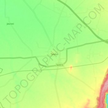
Nome: Mapa topográfico Tauru, altitude, relevo.
Local: Tauru, Taoru, Nuh District, Haryana, 122105, India (28.17093 76.91064 28.25093 76.99064)
Altitude média: 267 m
Altitude mínima: 211 m
Altitude máxima: 350 m
Obrigado por apoiar este site ❤️
Faça uma doação
Faça uma doação