
Mapa topográfico Gatesgarth
Clique no mapa para exibir a altitude.
Sobre este mapa
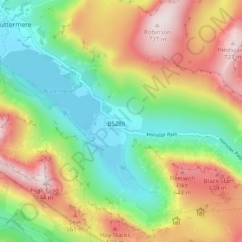
Nome: Mapa topográfico Gatesgarth, altitude, relevo.
Local: Gatesgarth, Buttermere, Cumberland, England, United Kingdom (54.50489 -3.26554 54.54489 -3.22554)
Altitude média: 369 m
Altitude mínima: 99 m
Altitude máxima: 736 m