
Mapa topográfico Augst
Mapa interativo
Clique no mapa para exibir a altitude.
Sobre este mapa
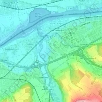
Nome: Mapa topográfico Augst, altitude, relevo.
Local: Augst, Bezirk Liestal, Basel-Landschaft, 4302, Schweiz (47.52267 7.68682 47.53978 7.73428)
Altitude média: 295 m
Altitude mínima: 258 m
Altitude máxima: 419 m
Zwischen der Ergolz und dem Violenbach liegt eine rund einen Quadratkilometer grosse Ebene, auf welcher die höher gelegenen Quartiere der römischen Stadt Augusta Raurica standen.
Outros mapas topográficos
Clique em um mapa para visualizar sua topografia, sua altitude e seu relevo.
Liestal
Schweiz > Basel-Landschaft > Bezirk Liestal
Liestal, Bezirk Liestal, Basel-Landschaft, 4410, Schweiz
Altitude média: 434 m