
Obrigado por apoiar este site ❤️
Faça uma doação
Faça uma doação
Mapa topográfico 50420
Clique no mapa para exibir a altitude.
Obrigado por apoiar este site ❤️
Faça uma doação
Faça uma doação
Sobre este mapa
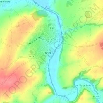
Nome: Mapa topográfico 50420, altitude, relevo.
Altitude média: 73 m
Altitude mínima: 37 m
Altitude máxima: 114 m
Obrigado por apoiar este site ❤️
Faça uma doação
Faça uma doação
Outros mapas topográficos
Clique em um mapa para visualizar sua topografia, sua altitude e seu relevo.