Mapa topográfico Hakuba
Clique no mapa para exibir a altitude.
Hakuba
The village has humid continental climate (Köppen Dfa), with cold, extremely snowy winters, and warm, rainy summers. With temperatures cooled by the elevation, monthly 24-hour average temperature ranges from −2.8 °C (27.0 °F) in January to 22.6 °C (72.7 °F) in July. Hakuba receives 6 meters of snowfall annually, with most snowfall occurring in the months of January and February.
Sobre este mapa
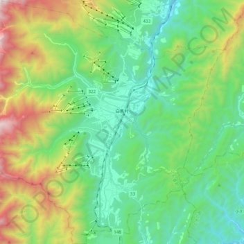
Nome: Mapa topográfico Hakuba, altitude, relevo.
Local: Hakuba, Kita-Azumi County, Nagano Prefecture, Japan (36.61393 137.75002 36.76769 137.94154)
Altitude média: 1.120 m
Altitude mínima: 528 m
Altitude máxima: 2.578 m
Outros mapas topográficos
Clique em um mapa para visualizar sua topografia, sua altitude e seu relevo.