
Faça uma doação
Mapa topográfico Khardung La
Clique no mapa para exibir a altitude.
Faça uma doação
Khardung La
The elevation of Khardung La is 5,359 m (17,582 ft). Local summit signs and dozens of stores selling shirts in Leh incorrectly claim its elevation to be in the vicinity of 5,602 m (18,379 ft) and that it is the world's second highest motorable pass.
Faça uma doação
Sobre este mapa
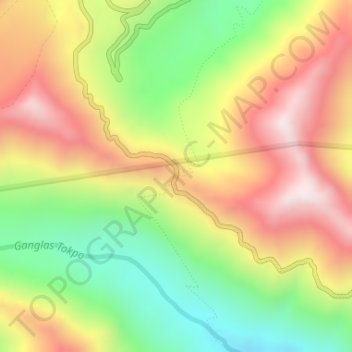
Nome: Mapa topográfico Khardung La, altitude, relevo.
Local: Khardung La, Leh district, Ladakh, India (34.27861 77.60464 34.27871 77.60474)
Altitude média: 5.235 m
Altitude mínima: 4.865 m
Altitude máxima: 5.628 m
Faça uma doação
Outros mapas topográficos
Clique em um mapa para visualizar sua topografia, sua altitude e seu relevo.
Faça uma doação
Faça uma doação
Indus
India > Ladakh > Leh Tehsil
In the uppermost, highest part of the Indus River basin there are relatively few genera and species: Diptychus, Ptychobarbus, Schizopyge, Schizopygopsis and Schizothorax snowtrout, Triplophysa loaches, and the catfish Glyptosternon reticulatum. Going downstream these are soon joined by the golden mahseer Tor…
Altitude média: 4.192 m