
Mapa topográfico Houthalen
Mapa interativo
Clique no mapa para exibir a altitude.
Sobre este mapa
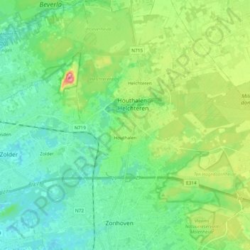
Nome: Mapa topográfico Houthalen, altitude, relevo.
Altitude média: 58 m
Altitude mínima: 26 m
Altitude máxima: 142 m
Outros mapas topográficos
Clique em um mapa para visualizar sua topografia, sua altitude e seu relevo.
Helchteren
België > Limburg > Maaseik > Houthalen-Helchteren
Helchteren, Houthalen-Helchteren, Maaseik, Limburg, Vlaanderen, België
Altitude média: 68 m
Houthalen-Oost
België > Limburg > Maaseik > Houthalen-Helchteren > Houthalen
Houthalen-Oost, Houthalen, Houthalen-Helchteren, Maaseik, Limburg, Vlaanderen, België
Altitude média: 78 m