
Faça uma doação
Mapa topográfico Serow
Clique no mapa para exibir a altitude.
Faça uma doação
Sobre este mapa
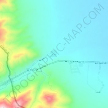
Nome: Mapa topográfico Serow, altitude, relevo.
Altitude média: 1.654 m
Altitude mínima: 1.560 m
Altitude máxima: 1.993 m
Faça uma doação
Outros mapas topográficos
Clique em um mapa para visualizar sua topografia, sua altitude e seu relevo.
Urmia
Iran > West Azerbaijan Province > Urumia County
The city lies at an altitude of 1,330 metres (4,360 ft) above sea level along the Shahar River on the Urmia Plain. Lake Urmia, one of the world's largest salt lakes, lies to the east of the city, and the border with Turkey lies to the west.
Altitude média: 1.386 m
Faça uma doação