
Faça uma doação
Mapa topográfico Hourtin
Clique no mapa para exibir a altitude.
Faça uma doação
Hourtin
Hourtin-Port is on the Lac d'Hourtin et de Carcans, one of the great lakes of the Landes. As well as port and boating facilities, many activities are planned for the children with a play park, a mini golf course and the children's island which is a large playground for the younger ones. The lake extends 18 km (11.2 mi) at its longest and 5 km (3.1 mi) at its widest, parallel to the Côte d'Argent on the Atlantic Ocean. It is the second largest natural freshwater lake in France after Lake Geneva. It lies at an elevation of 14 m (46 ft), and has a surface area of 56.67 km² (21.88 sq. miles). The lake has several sandy beaches left to the port and in Piqueyrot. It is shared with the city of Carcans.
Faça uma doação
Sobre este mapa
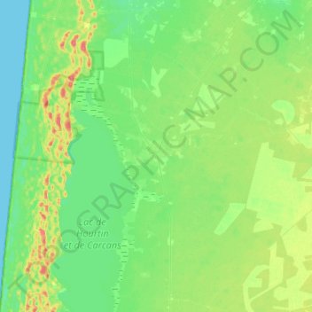
Nome: Mapa topográfico Hourtin, altitude, relevo.
Altitude média: 19 m
Altitude mínima: 0 m
Altitude máxima: 63 m
Faça uma doação