
Mapa topográfico Dalegarth
Clique no mapa para exibir a altitude.
Sobre este mapa
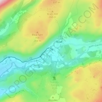
Nome: Mapa topográfico Dalegarth, altitude, relevo.
Altitude média: 165 m
Altitude mínima: 23 m
Altitude máxima: 439 m
Outros mapas topográficos
Clique em um mapa para visualizar sua topografia, sua altitude e seu relevo.
Blea Tarn
United Kingdom > England > Cumberland > Boot > Beckfoot
Blea Tarn is a lake in Eskdale, Cumbria, in the English Lake District, located about half a mile north of Beckfoot. Located at an elevation of 217 m (712 ft), the lake has an area of 3.3 hectares (8.2 acres) and measures 277 m × 150 m (909 ft × 492 ft), with a maximum depth of 11 m (36 ft).
Altitude média: 144 m