
Mapa topográfico Östersund
Mapa interativo
Clique no mapa para exibir a altitude.
Östersund
Though Östersund is in fact affected by the Gulf Stream, it lacks the high frequency of rain or snow following the currents. This is due to the Scandinavian Mountain Range acting as a natural barrier, receiving most of the precipitation, giving Östersund and the surrounding area a rain deficit. Another issue that has to be taken into account is the higher elevation of Östersund compared to the weather stations in Ångermanland farther east. For example, Sollefteå at a similar latitude 130 kilometres (81 mi) to the east but near sea level in an inland valley, has three degrees warmer July days. There is often temperature inversion between Östersund and lower areas in winter.
Sobre este mapa
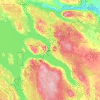
Nome: Mapa topográfico Östersund, altitude, relevo.
Local: Östersund, Östersunds kommun, Jämtland County, 831 86, Sweden (63.01937 14.47571 63.33937 14.79571)
Altitude média: 341 m
Altitude mínima: 248 m
Altitude máxima: 474 m
Outros mapas topográficos
Clique em um mapa para visualizar sua topografia, sua altitude e seu relevo.