
Mapa topográfico Fulda
Clique no mapa para exibir a altitude.
Sobre este mapa
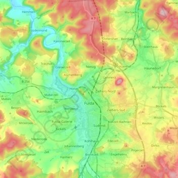
Nome: Mapa topográfico Fulda, altitude, relevo.
Local: Fulda, Landkreis Fulda, Hesse, Germany (50.49954 9.56614 50.62941 9.73298)
Altitude média: 324 m
Altitude mínima: 225 m
Altitude máxima: 470 m
Outros mapas topográficos
Clique em um mapa para visualizar sua topografia, sua altitude e seu relevo.
Milseburg
Germany > Hesse > Landkreis Fulda
The Milseburg is an extinct volcano and at 835 metres (2,740 ft) above sea level the second highest elevation in the Hessian part of the Rhön Mountains, Germany. The hill is located east of Fulda, near the villages of Kleinsassen and Danzwiesen. It is a popular destination for hikers and bikers.…
Altitude média: 619 m