
Mapa topográfico Plain
Clique no mapa para exibir a altitude.
Sobre este mapa
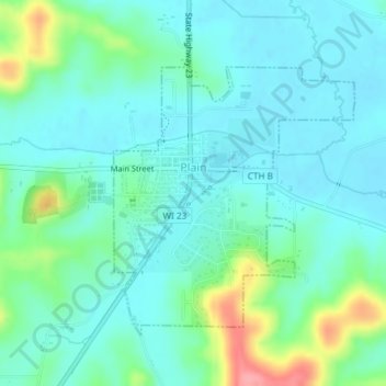
Nome: Mapa topográfico Plain, altitude, relevo.
Local: Plain, Sauk County, Wisconsin, United States (43.26705 -90.05143 43.28589 -90.02824)
Altitude média: 263 m
Altitude mínima: 240 m
Altitude máxima: 339 m
Outros mapas topográficos
Clique em um mapa para visualizar sua topografia, sua altitude e seu relevo.
Spirit Lake
United States > Wisconsin > Sauk County
Devils Lake State Park offers 29 miles of hiking trails that vary based on difficulty level, length, and terrain. Among the 17 established trails, the most popular is the tumbled rocks trail. It sits at the edge of the lake on the west end, stretching a mile long. The trail is paved, allowing it to be…
Altitude média: 349 m
Natural Bridge State Park
United States > Wisconsin > Sauk County > North Freedom
Altitude média: 289 m