
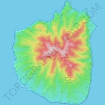
Mapa topográfico Little Barrier Island
Mapa interativo
Clique no mapa para exibir a altitude.
Sobre este mapa
Nome: Mapa topográfico Little Barrier Island, altitude, relevo.
Altitude média: 145 m
Altitude mínima: -2 m
Altitude máxima: 677 m
The island is steeply sloping, and deeply dissected by ravines radiating from a central range that peaks at Mount Hauturu whose altitude is 722 m (2,369 ft). Te Titoki Point is the only area of flat land on the island.