
Mapa topográfico Rathangan
Clique no mapa para exibir a altitude.
Sobre este mapa
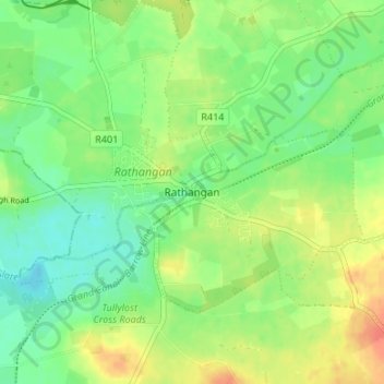
Nome: Mapa topográfico Rathangan, altitude, relevo.
Local: Rathangan, County Kildare, Leinster, Ireland (53.20033 -7.01297 53.24033 -6.97297)
Altitude média: 76 m
Altitude mínima: 58 m
Altitude máxima: 100 m