
Mapa topográfico Sutton Abinger
Mapa interativo
Clique no mapa para exibir a altitude.
Sobre este mapa
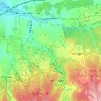
Nome: Mapa topográfico Sutton Abinger, altitude, relevo.
Altitude média: 146 m
Altitude mínima: 79 m
Altitude máxima: 244 m
Outros mapas topográficos
Clique em um mapa para visualizar sua topografia, sua altitude e seu relevo.
Abinger Bottom
United Kingdom > England > Surrey > Mole Valley > Abinger
Abinger Bottom, Abinger, Mole Valley, Surrey, England, RH5 6JN, United Kingdom
Altitude média: 196 m