Mapa topográfico Bhuj
Clique no mapa para exibir a altitude.
Bhuj
Bhuj has an average elevation of 110 metres (360 feet). On the eastern side of the city is a hill known as Bhujia Hill, on which there is a Bhujia Fort, that separates Bhuj city and Madhapar town ( considered one of the richest villages in Asia ). It has two lakes namely Hamirsar and Deshadsar (દેેેશળસર).
Sobre este mapa
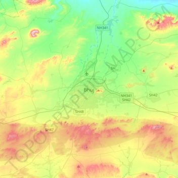
Nome: Mapa topográfico Bhuj, altitude, relevo.
Local: Bhuj, Bhuj Taluka, Kachchh, Gujarat, 370001, India (23.08724 69.50834 23.40724 69.82834)
Altitude média: 130 m
Altitude mínima: 10 m
Altitude máxima: 336 m
Outros mapas topográficos
Clique em um mapa para visualizar sua topografia, sua altitude e seu relevo.