
Mapa topográfico Fitzwilliam
Mapa interativo
Clique no mapa para exibir a altitude.
Sobre este mapa
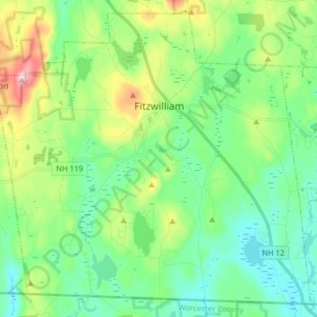
Nome: Mapa topográfico Fitzwilliam, altitude, relevo.
Altitude média: 345 m
Altitude mínima: 261 m
Altitude máxima: 565 m
According to the United States Census Bureau, the town has a total area of 36.0 square miles (93 km2), of which 34.6 sq mi (90 km2) is land and 1.4 sq mi (3.6 km2) is water, comprising 3.91% of the town. Little Monadnock Mountain, elevation 1,883 feet (574 m) above sea level, is the highest point in Fitzwilliam, located in the western part of town. The Metacomet-Monadnock Trail traverses the summit as does a shorter side trail from Rhododendron State Park. The town is drained by the South Branch of the Ashuelot River, the source of which is Bowker Pond. Fitzwilliam lies fully within the Connecticut River watershed.