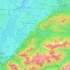
Mapa topográfico Hohenschwangau
Clique no mapa para exibir a altitude.
Sobre este mapa
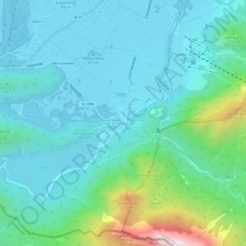
Nome: Mapa topográfico Hohenschwangau, altitude, relevo.
Altitude média: 1.002 m
Altitude mínima: 780 m
Altitude máxima: 2.007 m
Outros mapas topográficos
Clique em um mapa para visualizar sua topografia, sua altitude e seu relevo.

Neuschwanstein Castle
Germany > Bavaria > Landkreis Ostallgäu > Hohenschwangau
The municipality of Schwangau lies at an elevation of 800 m (2,620 ft) at the southwest border of the German state of Bavaria. Its surroundings are characterised by the transition between the Alpine foothills in the south (toward the nearby Austrian border) and a hilly landscape in the north that appears flat…
Altitude média: 982 m
Neuschwanstein Castle
Germany > Bavaria > Landkreis Ostallgäu > Schwangau > Hohenschwangau
The municipality of Schwangau lies at an elevation of 800 m (2,620 ft) at the southwest border of the German state of Bavaria. Its surroundings are characterised by the transition between the Alpine foothills in the south (toward the nearby Austrian border) and a hilly landscape in the north that appears flat…
Altitude média: 982 m
Neuschwanstein Castle
Germany > Bavaria > Landkreis Ostallgäu > Hohenschwangau
The municipality of Schwangau lies at an elevation of 800 m (2,620 ft) at the southwest border of the German state of Bavaria. Its surroundings are characterised by the transition between the Alpine foothills in the south (toward the nearby Austrian border) and a hilly landscape in the north that appears flat…
Altitude média: 982 m
Pfronten
Germany > Bavaria > Landkreis Ostallgäu
Pfronten is located on the northern edge of the Allgäu Alps. The Vils flows through the municipal territory. It is situated at an altitude of 853 m above sea level. NN at the foot of Edelsberg, Kienberg, Breitenberg and Falkenstein. The highest point of the municipality is the summit of the Aggenstein (1986 m…
Altitude média: 1.085 m

Hopfensee-Achen
Germany > Bavaria > Landkreis Ostallgäu > Füssen > Hopfen am See
Altitude média: 809 m




Ruine Falkenstein
Germany > Bavaria > Landkreis Ostallgäu > Pfronten > Benken
Originally known as Castrum Pfronten, the stone castle was built approximately 1270–1280 by Count Meinhard II of Tyrol on the borders of his land. Because of the unusual situation of the castle it has been interpreted in historical context as a symbol of opposition to the Duchy of Bavaria. (During the winter…
Altitude média: 940 m