
Obrigado por apoiar este site ❤️
Faça uma doação
Faça uma doação
Mapa topográfico Sandwich Bay
Clique no mapa para exibir a altitude.
Obrigado por apoiar este site ❤️
Faça uma doação
Faça uma doação
Sobre este mapa
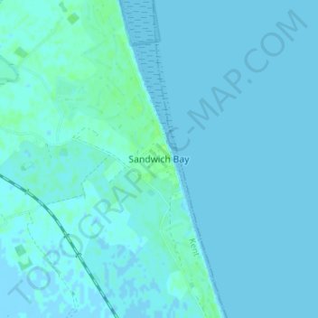
Nome: Mapa topográfico Sandwich Bay, altitude, relevo.
Local: Sandwich Bay, Dover, Kent, England, CT13 9PZ, United Kingdom (51.24779 1.36537 51.28779 1.40537)
Altitude média: 1 m
Altitude mínima: -3 m
Altitude máxima: 8 m
Obrigado por apoiar este site ❤️
Faça uma doação
Faça uma doação
Outros mapas topográficos
Clique em um mapa para visualizar sua topografia, sua altitude e seu relevo.
White Cliffs of Dover
United Kingdom > England > Kent > Dover > St. Margaret's at Cliffe
Altitude média: 49 m